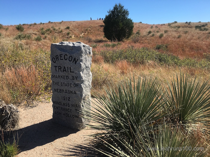
It never fails—traveling reveals magic. My trip to northwestern Nebraska this fall certainly did; I discovered a time machine.
The grass in the wagon ruts grows a different color (red), still marking the Oregon Trail. Photo Credit: Leah Nyfeler
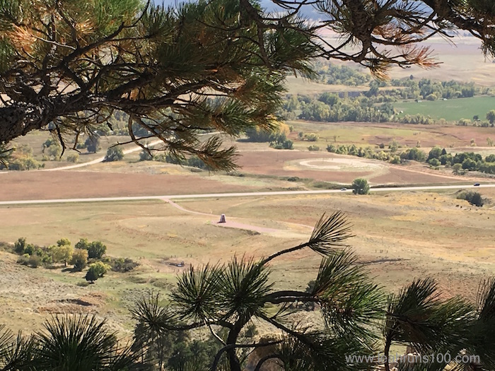
So many different days, I stood in a building or on a hill or plain and completely lost myself in the past. Goosebumps rippled my skin over pioneer wagon ruts still tracking the Oregon Trail. While the wind ripped through the trees, I looked down a craggy bluff at the trail Chief Dull Knife and his people travelled as they escaped massacre at Fort Robinson.
Looking down at the newly erected monument memorializing Chief Dull Knife and the Cheyenne Breakout from the hill climbed in their escape. Photo Credit: Leah Nyfeler
Hiking the trail from Hudson-Meng Bison Bonebed to Toadstool Geologic Park, though, was like going to church. Ancient Earth church.
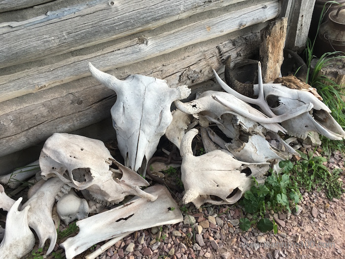
Cattle made the trek from Texas to Ogallala, Nebraska on the Western Trail. These skulls decorated High Plains Homestead, historic rustic lodging at the edge of the badlands. Photo Credit: Leah Nyfeler
Hudson-Meng Bison Bonebed is an archeological site in the Oglala National Grasslands where, for some reason, ancient bison came to die. These aren’t the modern bison we’re used to—these were giant animals, an extinct or transitory species, and their skeletons accumulated over a span of 600 years more than 9,000 years ago. Why did they return? Why did they perish? Many theories exist, but a popular one among the scientists who’ve worked the site is that, some 12,000 years ago, the area was a natural spring, which attracted animals who may’ve been caught in severe weather conditions.
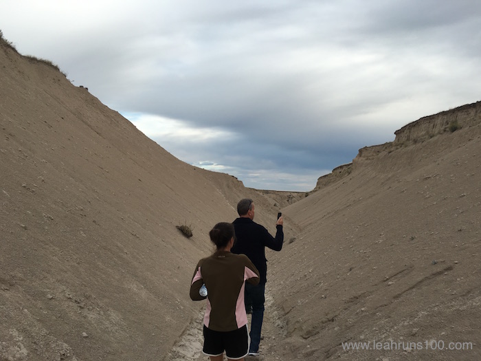
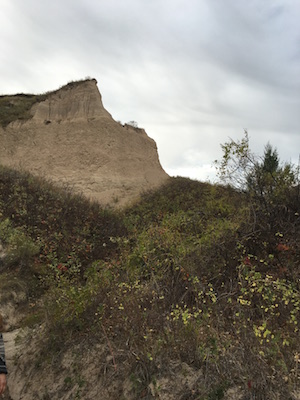
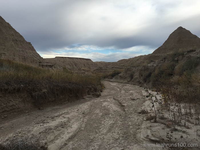
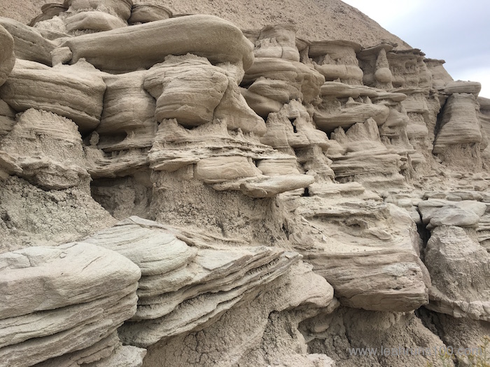
Formed some 38 to 24 millions years ago, Toadstool Geologic Park is a monument to eternity. It’s easy to picture earlier travelers on horseback navigating the harshly beautiful terrain, an introduction to Nebraska’s famous “badlands.” The park was sculpted out of rock by a prehistoric river; wind has sliced its way through, too, creating the park’s eponymous toadstool formations.
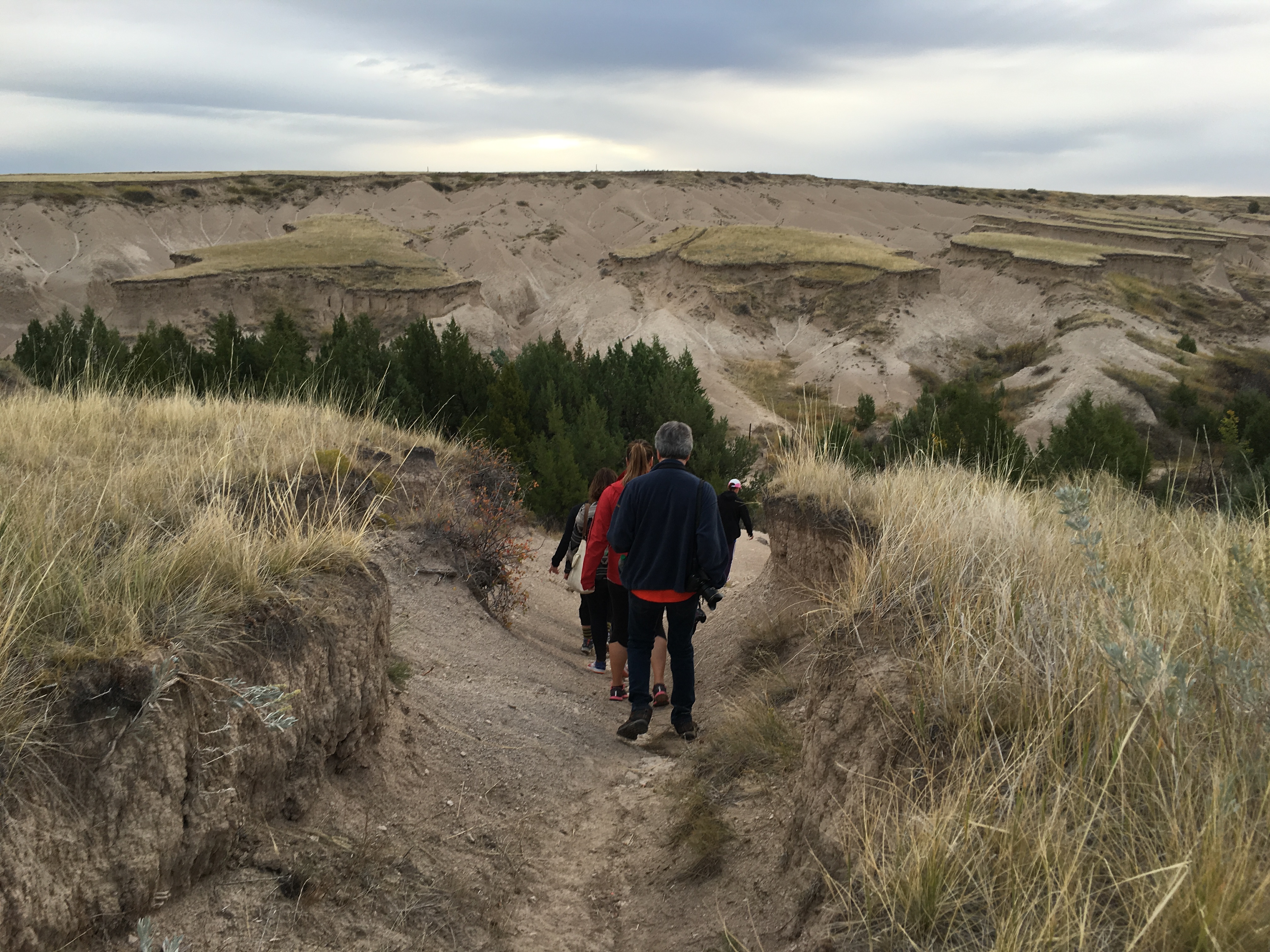
A 3-mile trail connects Hudson-Meng to Toadstool, and this is where Nebraska really worked her magic on me. Between the sunrise, changing terrain, incredible rock formations, and transmutable expanse of sky, this geologist’s daughter lost her heart. I admit to worshipping at this ancient outdoor church as we trekked along at dawn one late September morning.
The following photos give a better representation of that trip through time than any words could. At the end, I’ll have some links in case you’d like to go worship there, too.
Taking the Trail Through Time
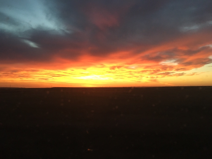
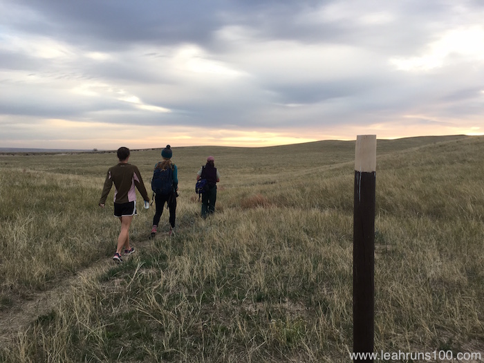
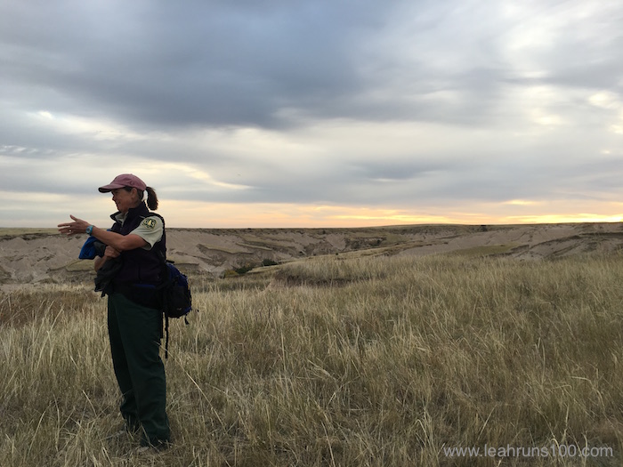
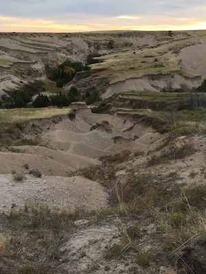
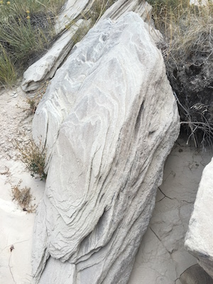
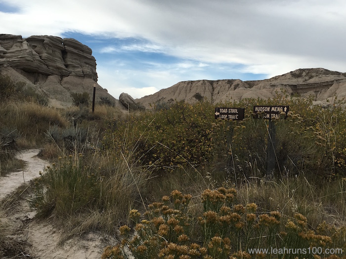
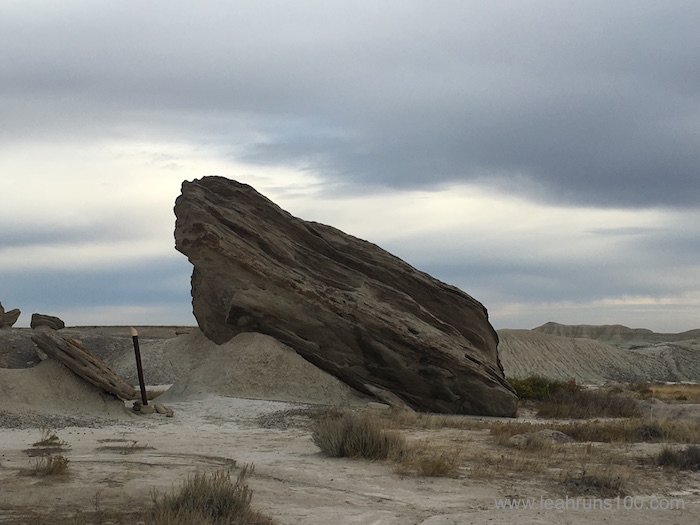
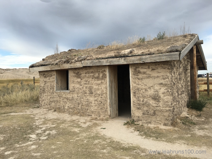
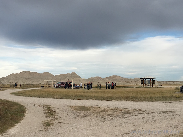
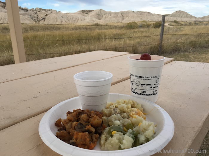
In Nebraska, all you had to do was point the camera and click for an amazing photo. This morning sky was photographed from a moving car through the window as I traveled to Hudson-Meng Bison Bonebed. Photo credit: Leah NyfelerCan you read the trail sign? We started from Hudson-Meng Bison Bonebed and Archeological Site early in the morning to beat the heat. Photo Credit: Leah NyfelerNebraska terrain changes as quickly as the sky. Hudson-Meng is part of the Pine Ridge; though it was consumed by wildfire (spread via 65 mph winds) in 2012, it’s coming back beautifully. Photo Credit: Leah NyfelerStarting out on the 3-mile Bison Trail connecting Hudson-Meng Bison Bonebed and Toadstool Geologic Park. Poles mark the trail. Photo Credit: Leah NyfelerAs part of the Oglala National Grasslands, Hudson-Meng and Toadstool fall under the care of the USDA Forest Service. The trails are open year round; seasonal ranger Robyn Cloughley guided us through the park on this beautiful late September day. Photo Credit: Leah NyfelerThe trail descends, changing from grassy prairie to river bottom. This is the trickiest footing of the trail, with loose gravel and hills to navigate. Photo Credit: Leah NyfelerWhen hiking, wear closed-toed walking shoes (trail running shoes were perfect). For those with balance problems, trekking poles would help with this descent, but the trail is generally an easy walk–even for young children. Bring water and check the weather before you go. Photo Credit: Leah NyfelerOnce you’ve descended, the transition to Toadstool Geologic Park becomes apparent. The terrain has been described as a “rocky moonscape.” Photo Credit: Leah NyfelerLooking up at the striated geology of the cliffs reveals the passage of time in stone’s color variations. Vegetation, like these wildflowers, dot the area and, in some spots, there is water in the river bed. Photo Credit: Leah NyfelerMuch of the well-marked trail simply meanders down the river bed. Sediment holds some of Nebraska’s oldest fossils and trackways. Though you can touch them–they’re all around!–collecting any fossils and tracks is not allowed. Photo Credit: Leah NyfelerThe toadstool formations, which give the park its name, range from giant (like this one, high on a ridge) to as small as a thumb. Photo Credit: Leah NyfelerEarthquakes and faults also created unique rock formations, like these slanted, rippled boulders. The closer to Toadstool Geologic Park, the larger and more varied they became. Photo Credit: Leah NyfelerToadstool Geologic Park and its rock formations are part of the White River Badlands, which extend through parts of Colorado, Wyoming, northwestern Nebraska, and South Dakota. Brule formations, named for Nebraska and South Dakota’s Brule Indians, are perhaps one of the most important of the White River formations because of their high fossil content. Photo Credit: Leah NyfelerIn addition to the 3-mile trail between Hudson-Meng and Toadstool, there is also a 1-mile loop trail near the Toadstool Geologic Park trailhead. Brochures are available for self-guided tours of the trails. Photo Credit: Leah NyfelerThe trail spills out into the public area of Toadstool Geologic Park, where several extremely large boulders can be climbed. Photo Credit: Leah NyfelerAt Toadstool Geologic Park, a typical Nebraskan pioneer sod house has been recreated. There are also modern amenities (parking, bathrooms, covered picnic tables, grills, information kiosk) at the trailhead. Photo Credit: Leah NyfelerTrailhead at Toadstool Geologic Park. According to District Ranger Tim Buskirk, Toadstool is their most popular campsite. Different rules apply to USDA Forest Service-maintained areas, and visitors are allowed to camp anywhere they can pitch a tent. Photo Credit: Leah NyfelerWe ended our morning trek with a delicious cowboy breakfast prepared in cast iron Dutch ovens by members of the Northwest Nebraska High Country. Why does everything taste so much better when cooked over an open fire? Photo Credit: Leah Nyfeler
Learn More About Northwestern Nebraska
There’s a bar and restaurant inside the cookshack—and a huge smoker and grill outside—at High Plains Homestead. Photo Credit: Leah Nyfeler
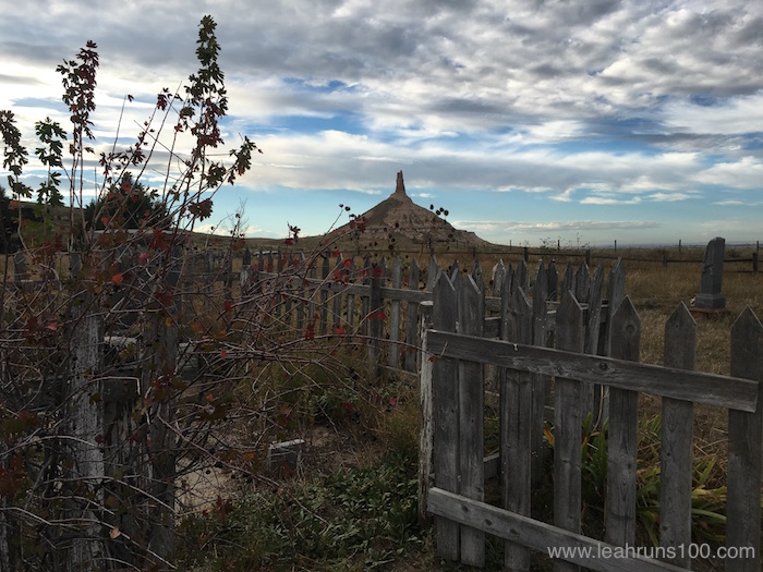
Pioneers, like the ones buried in the Chimney Rock cemetery, used iconic land formations like Chimney Rock to guide their travel.
(Visited 523 times, 1 visits today)
Related
Leah Nyfeler
I'm a writer, content marketer, and adventurer who is always looking for the another story, exciting adventure, new trail, and good meal/book/movie. I love sharing things I'm curious about, what I know, and how I've come to learn it. Read my blog, "Enjoying the Journey: Observations on the Fit Life" (leahruns100.com) and find my articles in a variety of print and online magazines.

 by
by